Building Capacity for Data-Driven Adaptation in Rural Coastal Communities

Overview
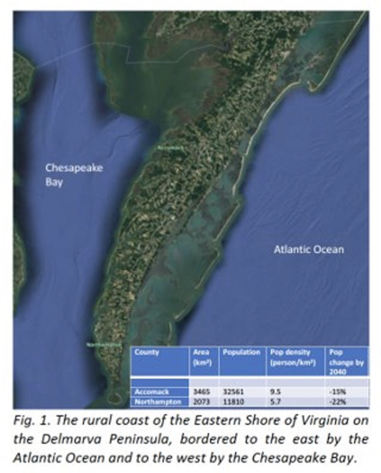
This project is part of a collaboration with UVA’s Environmental Resilience Institute to study climate impacts on the rural Eastern Shore of Virginia (ESVA), with the goal of developing tools and building the capacity for communities to deal with these impacts. We will develop a synthetic population that represents these communities by combining information across multiple sources of data, administrative and survey data, to get a representation of these rural communities down to the level of individual households and farms. This will be used as an input into agent based models for stakeholder decisions, and hydrological models to measure flood hazard, water supply, and groundwater salinization.
Research Question
How do coastal flooding and groundwater salinization impact crop production and coastal habitats?
Where are climate risks and inequities most pronounced now and in the future?
How will water security change across different communities? How does this change under different adaptation policies?
Goals
Overall Project Goals
Develop tools and building the capacity for communities to deal with the impacts of climate risk such as saltwater intrusion, accelerated sea level rise, storm flooding
Create an agent-based model to inform stakeholders' decisions
Create hydrological models to measure flood hazards, water supply, and ground water salinization
Summer Goals
Create a synthetic Population using IPF (Iterative Proportional Fitting)
Data discovery and cleaning down to the level of individual household/farm
Apply methods for demographic projections to predict how these populations will change over the next decades
Methods
Literature Review
Established familiarity with and understanding of current research on climate risks and synthetic methods to find out what research has already been done and identify what is unknown within the project
Data Inventory
Explored and assessed the usability, accuracy, and biases of possible national and state data sources to create sub-county level data sets to generate a synthetic population and demographic projections
Data Transformation
Manipulated Data from the Cropland Data Layer and C-CAP Regional Land Cover and Change by taking the original imported data and intersecting their geometries with parcel data from the Eastern Shore of Virginia. The purpose was to characterize crop production and land cover in each parcel to create data products to share with project collaborators
Synthetic Population
Used a technique called Iterative Proportional Fitting to generate a synthetic population down to the household level for Accomack and Northampton county using Census and housing data


